
Citizen Space Geospatial vs. Precisely Spectrum Spatial
| Product | Rating | Most Used By | Product Summary | Starting Price |
|---|---|---|---|---|
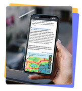 Citizen Space Geospatial | N/A | N/A | Citizen Space's geospatial tools let councils map consultations directly onto real locations. Residents can pinpoint exact sites, a proposed cycle lane, a planning application, a park redesign, and leave feedback tied to that spot. This turns abstract policy discussion into grounded, location-specific engagement, giving planners richer, more actionable public input. | N/A |
 Precisely Spectrum Spatial | Score7 out of 10 | N/A | Spectrum Spatial by Precisely (formerly from Pitney Bowes) makes enterprise location intelligence is achievable across any data silos that may exist. After ingestion, spatial data can be managed centrally, so users can determine the data needed and then combine it for a single, location-intelligent view. The software also includes visualization and analytics which work across devices. | N/A |
| Citizen Space Geospatial | Precisely Spectrum Spatial | |||||||||||||||
|---|---|---|---|---|---|---|---|---|---|---|---|---|---|---|---|---|
| Editions & Modules | No answers on this topic | No answers on this topic | ||||||||||||||
| Offerings |
| |||||||||||||||
| Entry-level Setup Fee | No setup fee | No setup fee | ||||||||||||||
| Additional Details | — | — | ||||||||||||||
| More Pricing Information | ||||||||||||||||