Overview
What is GeoHECHMS?
GeoHECHMS is a stormwater modeling software that accelerates the creation, analysis, and review of stormwater models. It automates various workflows to save valuable time for civil engineering businesses of all sizes. This software acts as a wrapper around HEC-HMS software using an AutoCAD-compatible...
Pricing
Entry-level set up fee?
- No setup fee
Offerings
- Free Trial
- Free/Freemium Version
- Premium Consulting/Integration Services
Would you like us to let the vendor know that you want pricing?
Alternatives Pricing
Product Details
- About
- Competitors
- Tech Details
What is GeoHECHMS?
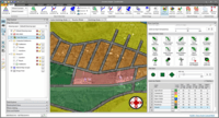
GeoHECHMS is a stormwater modeling software that accelerates the creation, analysis, and review of stormwater models. It automates various workflows to save valuable time for civil engineering businesses of all sizes. This software acts as a wrapper around HEC-HMS software using an AutoCAD-compatible graphical user interface, enabling users to quickly compare different scenarios and alternatives. Additionally, GeoHECHMS supports both US and metric (SI) units.
One key feature of GeoHECHMS is its ability to automate subbasin delineation, curve number computation using land use and soils maps, as well as lag time and time of concentration computation. As part of this automation process, it also offers automated watershed delineation, detention pond design capabilities and purpose-built stormwater design tools with comprehensive report generation options built-in. Overall, GeoHECHMS provides civil engineers an effective way to streamline stormwater modeling tasks so that they can focus on other important aspects of their work without losing much-needed productivity.
GeoHECHMS Screenshots
GeoHECHMS Video
GeoHECHMS Competitors
GeoHECHMS Technical Details
| Deployment Types | On-premise |
|---|---|
| Operating Systems | Windows |
| Mobile Application | No |
| Supported Languages | English |
Comparisons
Compare with
Reviews
Community Insights
- Business Problems Solved
- Pros
- Cons
Users of GeoHECHMS have found the software to be an effective solution for various business problems. One of the primary use cases of the software is its ability to centralize previously scattered online databases into a single platform, which offers intuitive on-demand analysis and design tools. By doing so, users are able to save hours, days, and even weeks on tedious hydrologic hydraulic tasks.
Another important problem solved by the software is its compatibility with all relevant and important software, including AutoCAD, MicroStation, ESRI ArcGIS, and HEC-HMS, making it an effective and efficient technology. Users have also reported that workflow efficiency has increased considerably due to the software's improved GUI, which saves model setup time. Additionally, GeoHECHMS's automated TOC calculations improve accuracy, allowing users to provide value-added services for clients. Finally, this software allows users to solve complex and detailed flood studies in ungaged basins while saving time and effort through intuitive user experience.
User-friendly software: Users have consistently praised the user-friendliness of GeoHECHMS, with many stating that it is easy to use and navigate. The clear interface has made it a valuable tool for hydrologic hydraulic analysis and design, allowing users to streamline their work processes.
Efficient analysis and design: A significant number of users have lauded GeoHECHMS' ability to save them time during analysis and design. The software allows for the automated calculation of parameters such as Curve Numbers and Time of Concentrations, greatly simplifying the setup of models while maintaining accuracy. Additionally, the program's streamlined interface makes it much easier to extract tables for reports than previous programs.
Responsive customer service: Customers appreciate GeoHECHMS' 24/7 project-specific support team, which provides assistance in real-time. Several reviewers have noted that this level of support is unheard-of in the industry, demonstrating how committed CivilGEO is to its customers. In addition, if any issues do arise with the software itself, users report that the CivilGEO team is immediately responsive and goes above and beyond to assist them with their projects.
Limited Stormwater BMP Design: Some users have expressed disappointment in the lack of stormwater Best Management Practices (BMP) design functionality within GeoHEC-HMS, which requires them to use other software. This can be inconvenient and time-consuming for those who would prefer an all-in-one solution.
Difficult basin delineation: Several reviewers have reported difficulty getting basins delineated exactly as they would like, especially depending on the size of the basin. Some auto-generating tools do not work perfectly, leading to frustration among some users.
Software updates required: Many models require newer versions of the HEC-HMS analysis engine than what is available in GeoHEC-HMS. This means that updating subbasins is necessary to run the model successfully within this software, causing some inconvenience for users accustomed to using older versions.


