

Overview
What is IGiS Desktop (Powered by Scanpoint Geomatics Limited)?
IGiS Desktop provides advanced GIS software for GIS mapping and image processing by aiming to use innovative ways of analyzing, visualizing, and processing geographic data.IGiS Desktop aims to redefine the GIS software industry with integrated GIS mapping, and image processing…
Leaving a review helps other professionals like you evaluate Geographic Information Systems
Be the first one in your network to review IGiS Desktop (Powered by Scanpoint Geomatics Limited), and make your voice heard!
Get StartedPricing

What is IGiS Desktop (Powered by Scanpoint Geomatics Limited)?
IGiS Desktop provides advanced GIS software for GIS mapping and image processing by aiming to use innovative ways of analyzing, visualizing, and processing geographic data. IGiS Desktop aims to redefine the GIS software industry with integrated GIS mapping, and image processing…
Entry-level set up fee?
- No setup fee
Offerings
- Free Trial
- Free/Freemium Version
- Premium Consulting/Integration Services
Would you like us to let the vendor know that you want pricing?
2 people also want pricing
Alternatives Pricing

What is Mapbox?
Mapbox is the location data platform for developers building custom geospatial features into mobile, web, and on-premise applications.

What is QGIS?
QGIS (formerly Quantum GIS) is a free and open source geographic information system.
Product Details
- About
- Competitors
- Tech Details
What is IGiS Desktop (Powered by Scanpoint Geomatics Limited)?
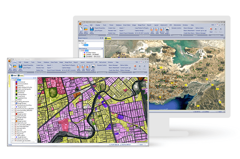
IGiS Desktop aims to redefine the GIS software industry with integrated GIS mapping, and image processing capabilities with advanced analysis extensions on a single platform. It makes collaboration easy with OGC-supported platforms. Standardized UI and ribbon-based navigation make the user-interface intuitive and interactive.
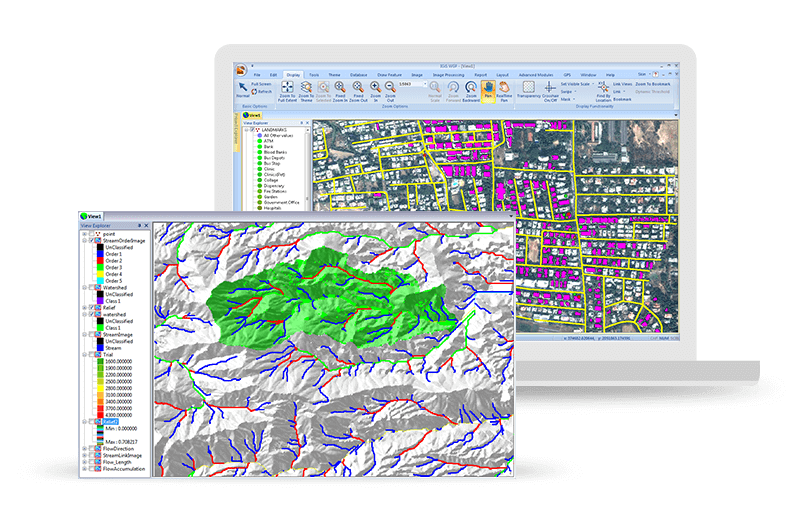
IGiS Desktop has advanced tools for GIS data conversion, GIS analysis, and visualization. It comes with tools like topology creation, geo-processing, overlay analysis, an attribute query builder for advanced geospatial users.
It has cartographic and visualization tools for the conception, production, dissemination, and study of 2D and 3D maps. It is a 64-bit, Unicode Desktop GIS with a user interface where data can be viewed in multiple tabs using Multiple Document Interface (MDI).
It enables users to store, manage and edit geospatial data, and supports data integration for a wide range of geospatial data formats including real-time and big data. Integration of Open Geospatial Consortium (OGC) Standards enables users to store and share data with other users through privileged authentication.
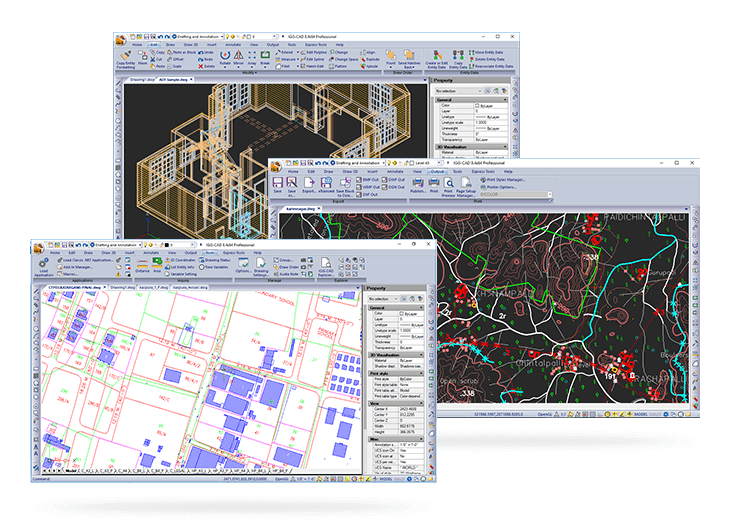
It's a GIS technology integrated with the Computer-aided design (CAD) module which builds extensive GIS mapping software to carry out cartographic as well as engineering capabilities for real-world objects.
IGiS Desktop (Powered by Scanpoint Geomatics Limited) Features
- Supported: Integrated GIS and Efficient Image Processing capabilities
- Supported: Advanced Geo-processing
- Supported: Integrated CAD Tool
IGiS Desktop (Powered by Scanpoint Geomatics Limited) Screenshots


IGiS Desktop (Powered by Scanpoint Geomatics Limited) Technical Details
| Deployment Types | On-premise |
|---|---|
| Operating Systems | Windows |
| Mobile Application | No |


