Overview
What is PolicyMap?
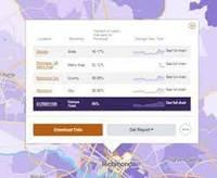
PolicyMap offers online mapping with data on demographics, real estate, health, jobs and communities across the US.
Pricing
Entry-level set up fee?
- No setup fee
Offerings
- Free Trial
- Free/Freemium Version
- Premium Consulting/Integration Services
Would you like us to let the vendor know that you want pricing?
2 people also want pricing
Alternatives Pricing
Product Demos
PolicyMap Demo
Product Details
- About
- Competitors
- Tech Details
What is PolicyMap?
PolicyMap products are powered by a library of indicators, from public and proprietary sources. The data comes from disparate sources, but is standardized to allow for simple analysis across indicators. Specific data, such as trends over time and indices is combined to create relevant indicators. Data licensing using a data API or flat file delivery, to feed data directly into a platform from the up-to-date data warehouse and integrated Mapping Tools for creating an interactive mapping applications are also available.
PolicyMap Screenshots
PolicyMap Video
PolicyMap Competitors
- Google Maps API
- BatchGeo
- Esri ArcGIS.
PolicyMap Technical Details
| Deployment Types | Software as a Service (SaaS), Cloud, or Web-Based |
|---|---|
| Operating Systems | Unspecified |
| Mobile Application | No |
Comparisons
Compare with
Reviews
Community Insights
- Business Problems Solved
- Pros
- Cons
PolicyMap is a versatile software that helps non-profits like Community Action Agencies and business owners understand the demographics of the area in which they operate. It is a go-to source for users seeking to maintain compliance with CDFI regulations, as it allows individuals to identify locations and potential projects for programs like LIHTC and NMTC, evaluate their potential, and complete annual needs assessments using demographic and other data.
Users appreciate PolicyMap because it integrates data with other marketing and sales information to identify optimal brand expansion opportunities for clients. The mapping tool allows users to tell complex stories in maps that are easy to comprehend, making it crucial for telling critical stories quickly and efficiently. As a result, PolicyMap is used extensively by users who need to gain geographic insights into their non-profit work or write effective grant applications. Its remarkable reliability and exceptional support make it a top choice for many users who have tried similar solutions in the past.
Easy Navigation: Users have consistently found PolicyMap's platform easy to navigate (multiple users). The software has a user-friendly interface that makes it simple for users to find the data they need quickly and efficiently. Additionally, its intuitive design allows new users to be up and running with minimal training.
Time-Saving: Many users appreciate the volume of data available on PolicyMap, which saves them significant amounts of time compared to searching for data on multiple sites (multiple users). With all of the necessary information in one place, researchers can focus more on analysis than data collection.
Consistency of Data: The consistency of data provided by PolicyMap is incredibly helpful for users (multiple users). Having reliable data from a single source eliminates discrepancies between datasets and provides accurate insights into research questions.
Challenging Data Visualization: Some users have found it challenging to visualize all the data available at different levels of geography. This has made it difficult for them to assess individual data sources for measures.
Expensive Pricing: The software's pricing was reported by some users to be expensive, making it difficult for non-profits to use.
Non-Intuitive User Interface: Some users expressed that PolicyMap's user interface is not intuitive and can be hard to navigate without any training, which impacted their overall experience with the software.


