Chose IBM Environmental Intelligence Suite (EIS)
Cority One and EnviroSuite

| Product | Rating | Most Used By | Product Summary | Starting Price |
|---|---|---|---|---|
 IBM Environmental Intelligence Suite (EIS) | N/A | The IBM Environmental Intelligence Suite is an AI-powered SaaS solution that provides intelligence to proactively manage the economic impact of severe weather and climate-change events built on weather data. | N/A | |
 MAPOG | N/A | MAPOG is a mapping platform that transforms locations, projects, portfolios, and data into interactive visual maps. Instead of scattered files or reports, users can import data from CSV or Excel and display every site on a single map with photos, videos, links, and key details for each point. Users can add custom base maps using geo-referencing to showcase campuses, layouts, or property overviews, and use bearing angle measurement for navigation, planning, or… | $9 per month per user |
| IBM Environmental Intelligence Suite (EIS) | MAPOG | |||||||||||||||
|---|---|---|---|---|---|---|---|---|---|---|---|---|---|---|---|---|
| Editions & Modules | No answers on this topic |
| ||||||||||||||
| Offerings |
| |||||||||||||||
| Entry-level Setup Fee | No setup fee | No setup fee | ||||||||||||||
| Additional Details | — | Pro Plan: Best for individuals, startups, or small teams. Includes up to 10 maps, 1,000 story points, basic geocoding, and AI-powered story creation. Monthly: $9.0/month Annual: $7.5/month ($90/year, save up to 40% with annual billing) Business Plan: Ideal for growing teams needing more maps, data points, advanced geocoding, layer tools, and GIS AI queries. Monthly: $21.0/month Annual: $21/month ($252/year, save up to 40% with annual billing) Business+ Plan: Designed for large enterprises with unlimited maps, up to 1,000,000 story points, 8 GB storage, enterprise-grade collaboration, and premium support. Monthly: $99.0/month Annual: $58/month ($696/year, save up to 40% with annual billing) Additional Users: Add team members for $5.63/month | ||||||||||||||
| More Pricing Information | ||||||||||||||||
| IBM Environmental Intelligence Suite (EIS) | MAPOG | |
|---|---|---|
| Considered Both Products | IBM Environmental Intelligence Suite (EIS) |  MAPOG No answer on this topic |
| IBM Environmental Intelligence Suite (EIS) | MAPOG | |
|---|---|---|
| Small Businesses |  ArcGIS Score 7.9 out of 10 | ArcGIS Score 7.9 out of 10 |
| Medium-sized Companies | ArcGIS Score 7.9 out of 10 | ArcGIS Score 7.9 out of 10 |
| Enterprises | ArcGIS Score 7.9 out of 10 | ArcGIS Score 7.9 out of 10 |
| All Alternatives | View all alternatives | View all alternatives |
| IBM Environmental Intelligence Suite (EIS) | MAPOG | |
|---|---|---|
| Likelihood to Recommend | 7.7 (0 ratings) | - (0 ratings) |
| Usability | 6.5 (0 ratings) | - (0 ratings) |
| IBM Environmental Intelligence Suite (EIS) | MAPOG | |
|---|---|---|
| Likelihood to Recommend |
| No answers on this topic |
| Pros |
| No answers on this topic |
| Cons |
| No answers on this topic |
| Usability |
| No answers on this topic |
| Alternatives Considered | | No answers on this topic |
| Return on Investment |
| No answers on this topic |
| ScreenShots | MAPOG Screenshots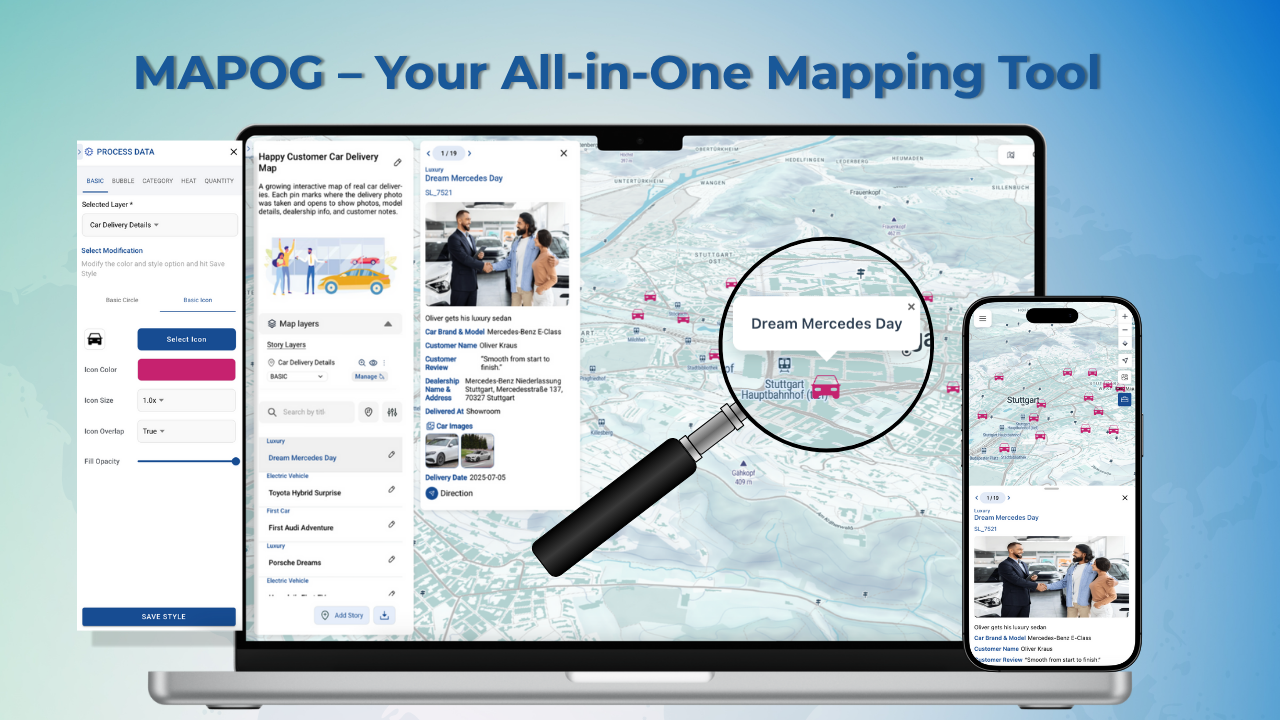 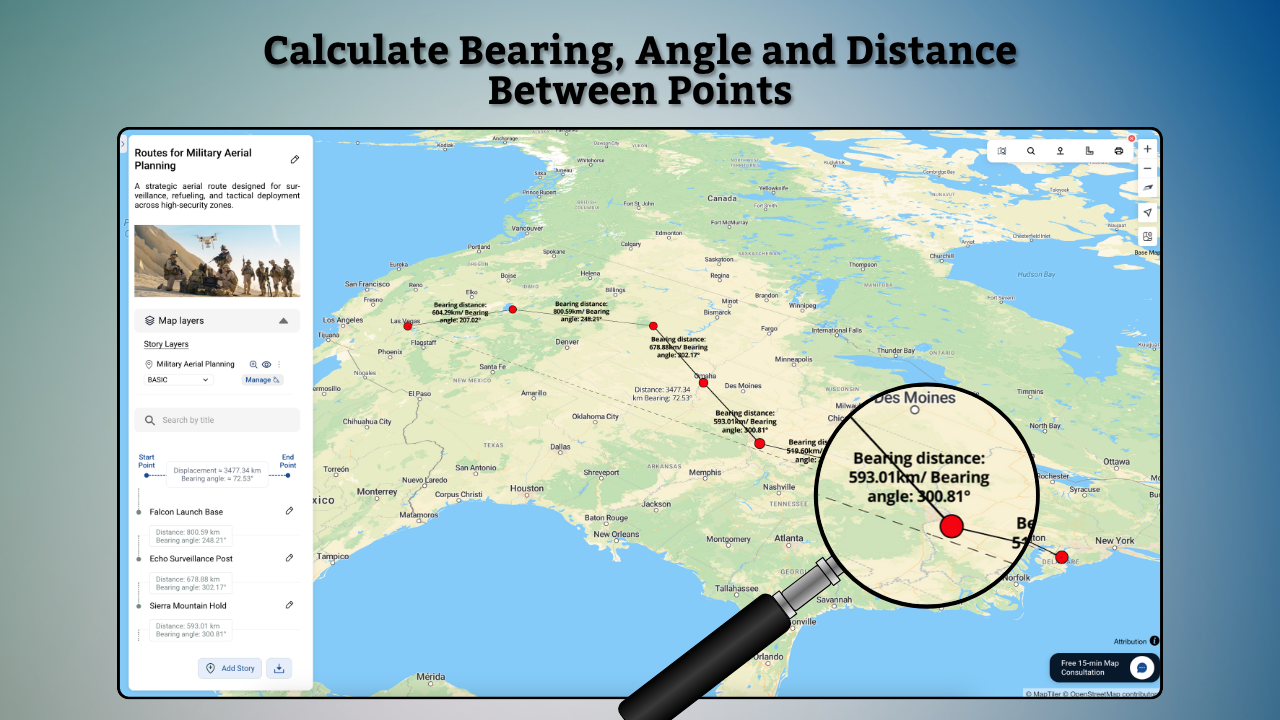  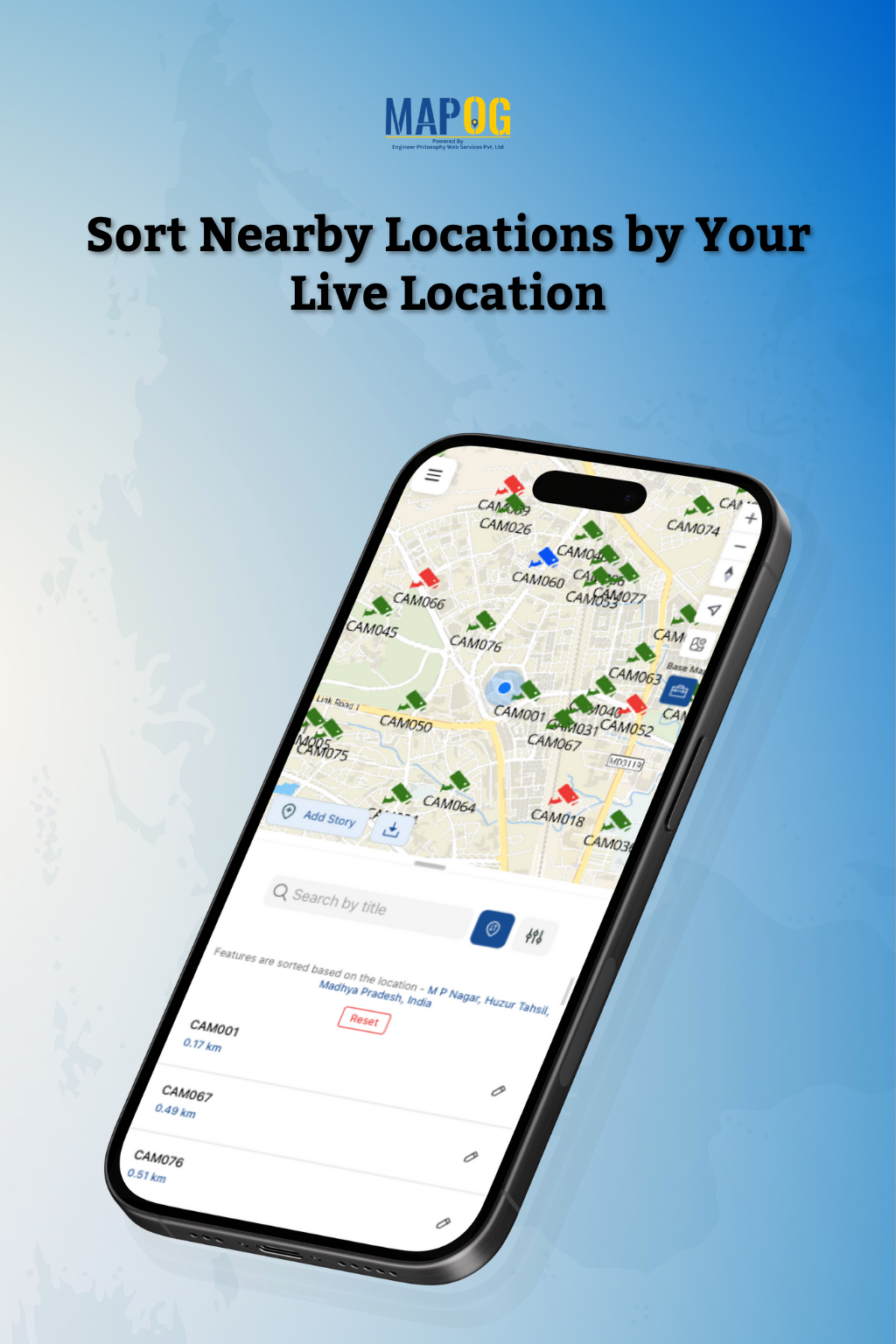 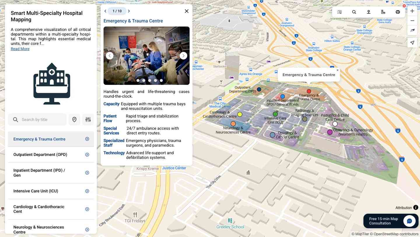 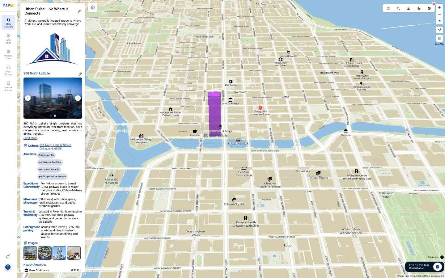 |