
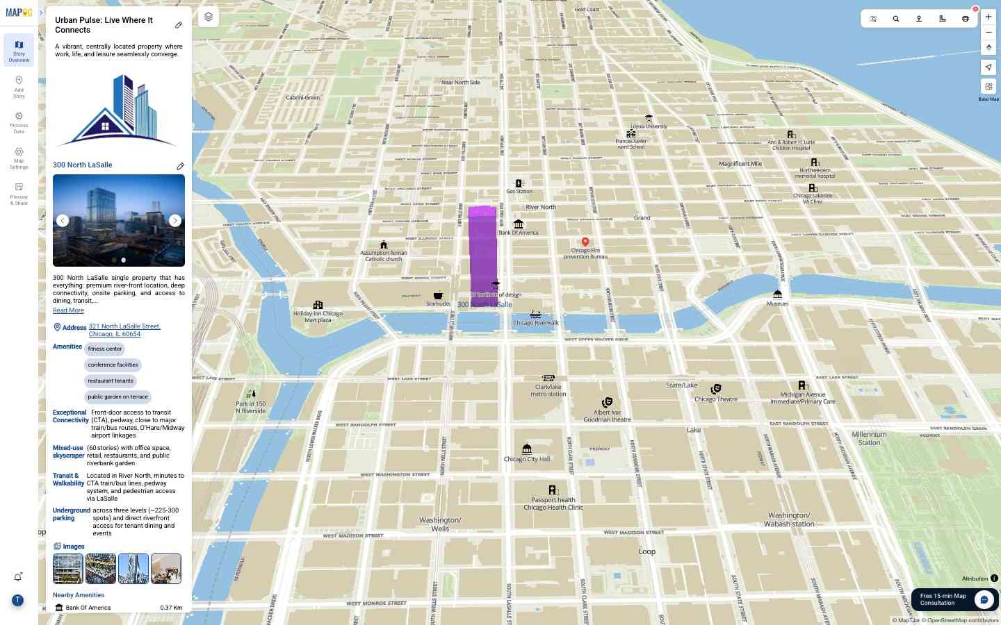
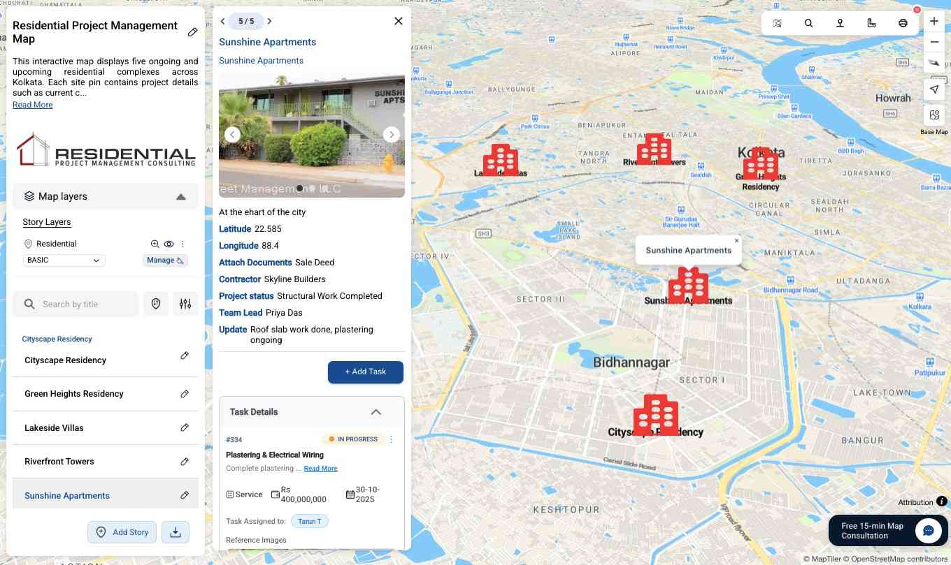
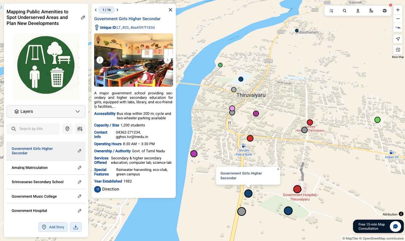
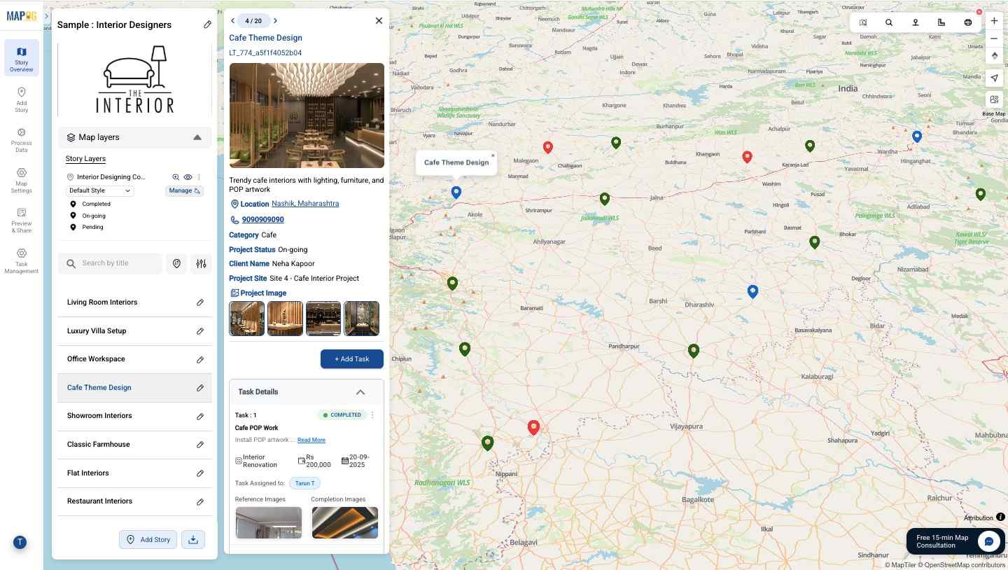
What is MAPOG?
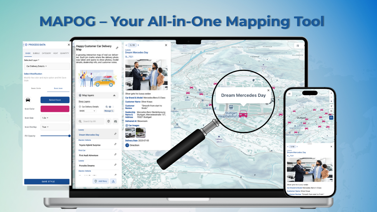
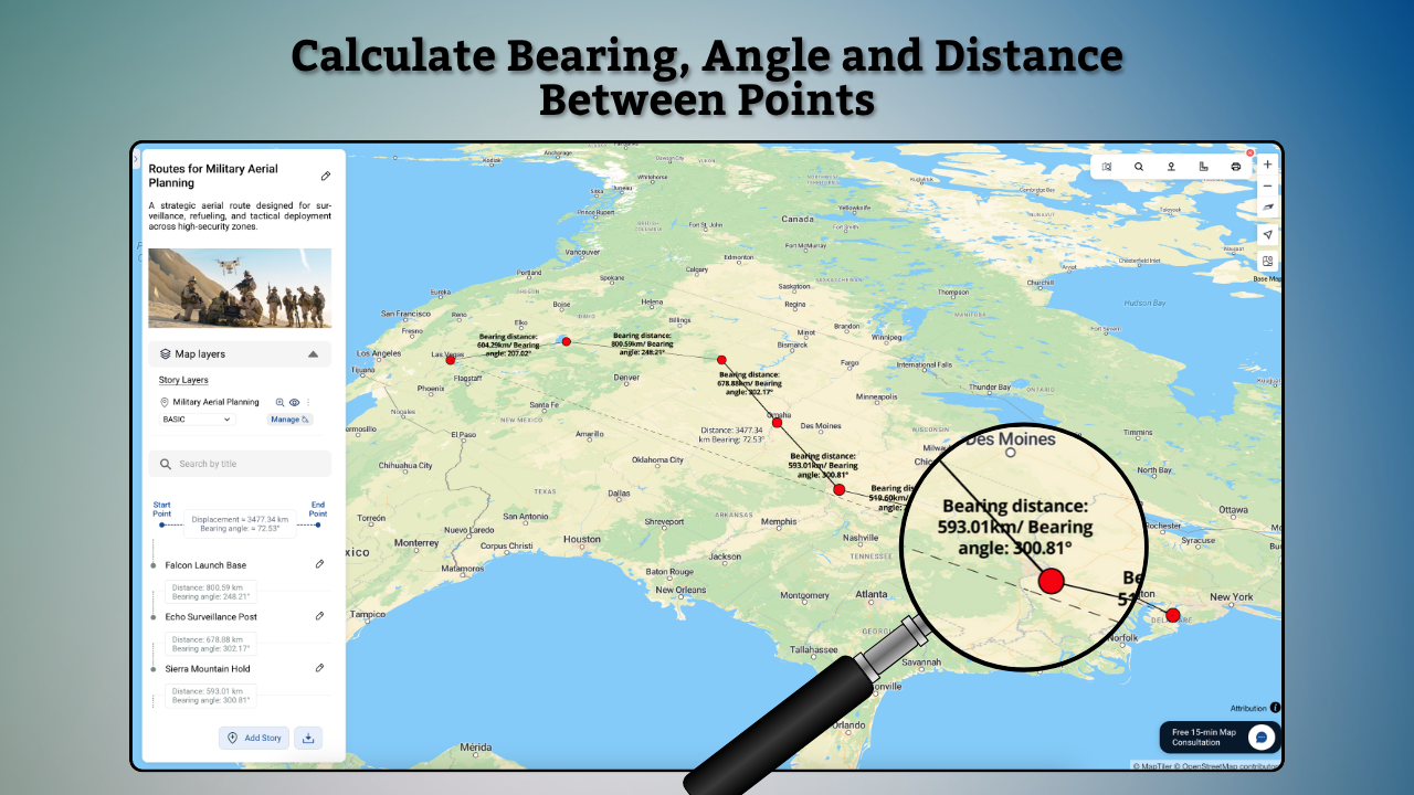
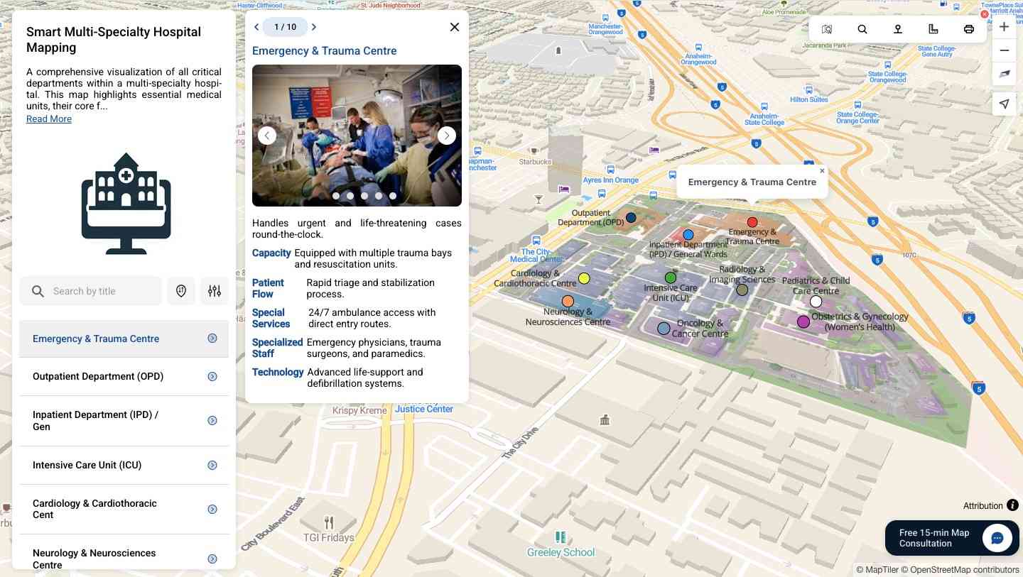
MAPOG is a mapping platform that transforms locations, projects, portfolios, and data into interactive visual maps. Instead of scattered files or reports, users can import data from CSV or Excel and display every site on a single map with photos, videos, links, and key details for each point. Users can add custom base maps using geo-referencing to showcase campuses, layouts, or property overviews, and use bearing angle measurement for navigation, planning, or surveying.
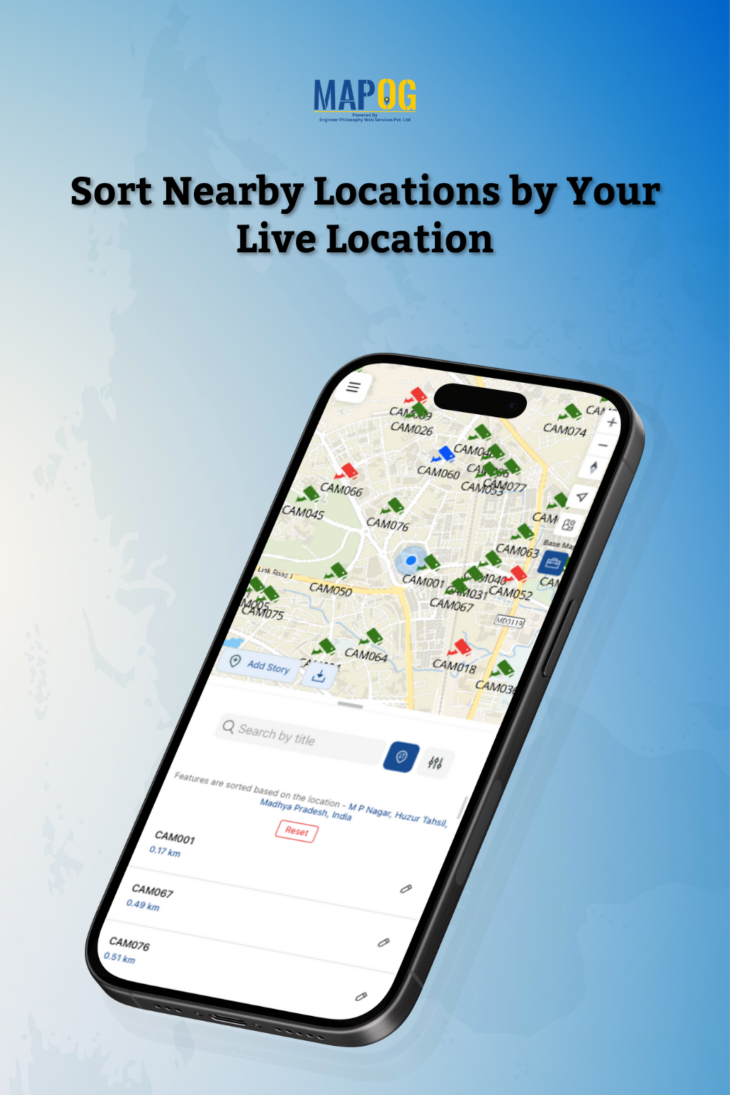
MAPOG supports collecting and updating field data through its mobile data collection capability. Users can assign and track tasks with its task management feature, and sort nearby sites by live location for faster visits and maintenance. To organize maps, MAPOG offers layers and filters, analysis of nearby places, and the ability to export offline for reports or presentations. Sharing can be done through role-based access or public/private links, making MAPOG an all-in-one mapping solution for real estate, travel, education, and logistics.
Categories & Use Cases
Media


1 / 21
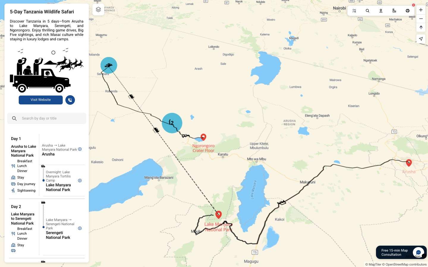
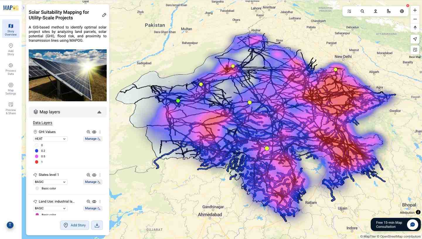
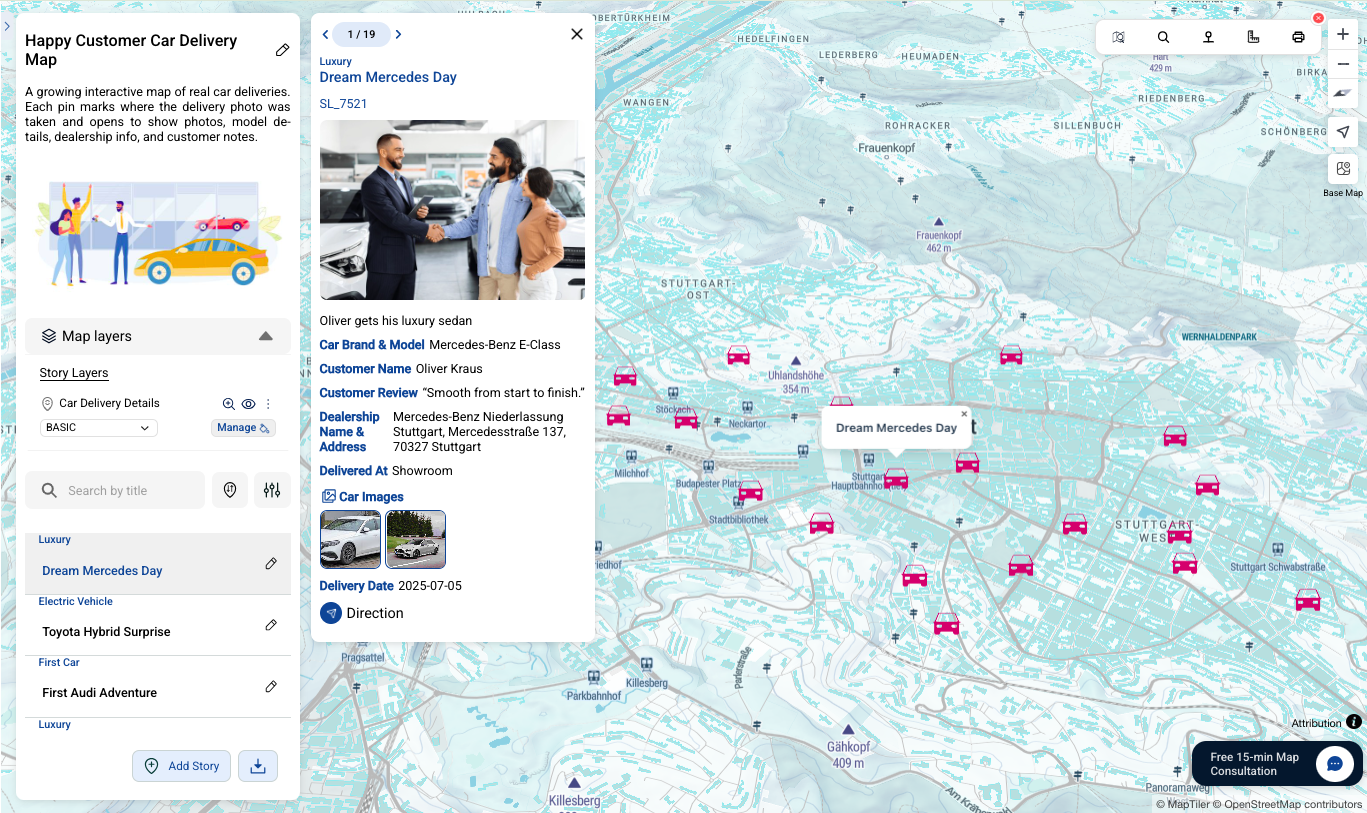
Screenshot of MAPOG's Interactive Maps