
What is Optelos?
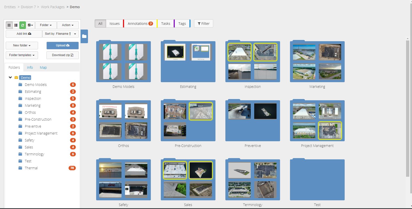
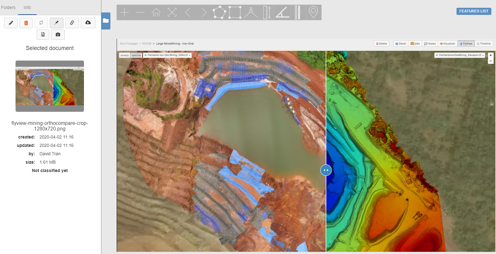
Optelos is a data management and AI analytics platform that addresses the needs of large enterprises to standardize visual asset inspection data management, workflow administration, team collaboration enablement and IT security policy enforcement. Optelos transforms visual and sensor asset inspection data into actionable insights through our patented technology that geolocates and correlates visual and sensor inspection data from multiple sources into an intuitive, searchable and contextualized database. The unified database is ready for AI implementation, detailed analysis, advanced image modeling and enterprise systems integration for asset inspection program automation and improved data leverage. Use Optelos to create 3D pointcloud digital twins of your key assets, entire industrial sites, or job sites at specific stages of development.
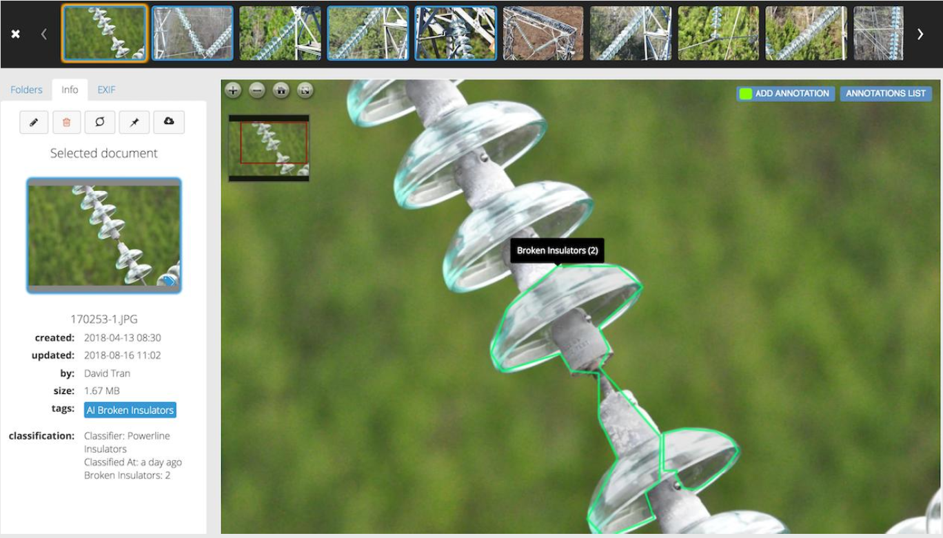
Optelos includes tools needed to develop, test and deploy computer vision AI to automate any inspection process, then direct remediation actions to the precise geolocation of the detected defect. Optelos compresses the time it takes to accurately perform inspections through computer vision AI, automating issue identification, classification, prioritization and geolocation to speed repairs of detected faults and better leverage scarce resources.
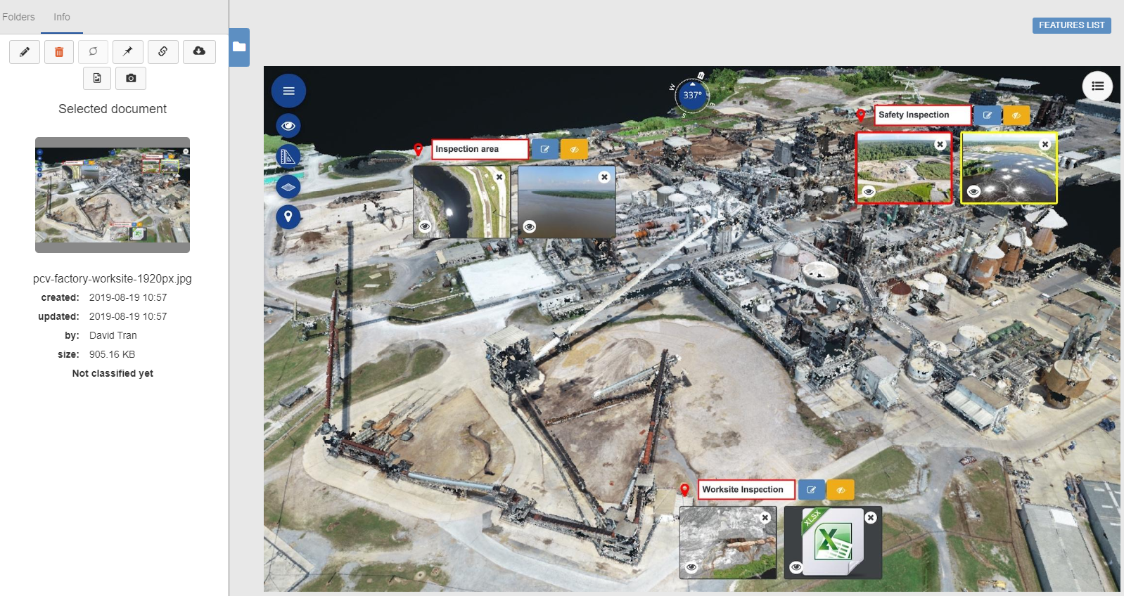
Optelos also includes features which can be leveraged to improve the effectiveness and efficiency of shutdowns, turnarounds and outages. Turnaround Advisor™ functionality allows maintenance teams to select specific site areas or parts of a larger system for closer inspection and viewing without visual impairment from nearby physical obstructions. Rotate, dissect and visually inspect down to pixel-level detail items selected for maintenance action, ensuring you have a complete and detailed view of equipment in preparation for maintenance actions. Store all project inspection images in a visually intuitive manner, and append your 3D pointcloud models with recent inspection information, regulatory requirement documents, project plans or start-up procedures. Sharing detailed inspection information and visual equipment status data has never been easier or more intuitive.Categories & Use Cases
Screenshots


1 / 7
Screenshot of Aggregate and Organize Visual Data - Patented technology geolocates and correlates data from any source, organizing vast amounts of unstructured data into an intuitive, contextualized and searchable database ready for analysis and AI implementation.
Technical Details
| Deployment Types | On-Premise, SaaS |
|---|---|
| Operating Systems | Windows |
| Mobile Application | No |
| Supported Countries | Global |
| Supported Languages | English, Spanish |