ArcGIS vs. GeoSurf
ArcGIS vs. GeoSurf
| Product | Rating | Most Used By | Product Summary | Starting Price |
|---|---|---|---|---|
 ArcGIS | N/A | Esri in Redlands, California offers ArcGIS, a geographic information system. | $100 per year | |
 GeoSurf | N/A | GeoSurf is browser toolbar that enables users to get the local perspective from more than 110 global locations. It is often used by online media professionals (buyers, campaign managers, sales, affiliates, and compliance teams) to view geo-targeted ads and web content. This way, they can easily validate and monitor campaigns, see who is bidding on localized ad placements, generate new sources of business, and enhance current marketing activities. The interface is a straight-forward toolbar which… | $89 month |
| ArcGIS | GeoSurf | |||||||||||||||
|---|---|---|---|---|---|---|---|---|---|---|---|---|---|---|---|---|
| Editions & Modules |
|
| ||||||||||||||
| Offerings |
| |||||||||||||||
| Entry-level Setup Fee | No setup fee | No setup fee | ||||||||||||||
| Additional Details | — | Interested in Enterprise plan? Contact the vendor for details. | ||||||||||||||
| More Pricing Information | ||||||||||||||||
| ArcGIS | GeoSurf | |
|---|---|---|
| Top Pros |
| |
| Top Cons |
|
|
| ArcGIS | GeoSurf | |
|---|---|---|
| Small Businesses |  Google Maps API Score 8.8 out of 10 | No answers on this topic |
| Medium-sized Companies | Google Maps API Score 8.8 out of 10 | No answers on this topic |
| Enterprises | Google Maps API Score 8.8 out of 10 | No answers on this topic |
| All Alternatives | View all alternatives | View all alternatives |
| ArcGIS | GeoSurf | |
|---|---|---|
| Likelihood to Recommend | 10.0 (39 ratings) | 8.4 (45 ratings) |
| Likelihood to Renew | 8.0 (1 ratings) | 10.0 (2 ratings) |
| Usability | 10.0 (2 ratings) | 9.0 (2 ratings) |
| Availability | - (0 ratings) | 10.0 (1 ratings) |
| Performance | - (0 ratings) | 10.0 (1 ratings) |
| Support Rating | 9.0 (12 ratings) | 10.0 (2 ratings) |
| Online Training | - (0 ratings) | 9.0 (1 ratings) |
| Implementation Rating | - (0 ratings) | 10.0 (1 ratings) |
| ArcGIS | GeoSurf | |
|---|---|---|
| Likelihood to Recommend |  Esri
 Rachel Piper Middle School Humanities Teacher |  BIScience
|
| Pros | Esri
| BIScience
 Alexander Delivlaev Quality Assurance with Test Automation |
| Cons | Esri
| BIScience
 John Beaver Software Integration Architect |
| Likelihood to Renew | Esri
 Rafael Becemberg Jefe del departamento de Oceanografia | BIScience
 Lital Barkan Freelance Marketing and Business Development |
| Usability | Esri
| BIScience
|
| Reliability and Availability | Esri No answers on this topic | BIScience
Lital Barkan Freelance Marketing and Business Development |
| Performance | Esri No answers on this topic | BIScience
Lital Barkan Freelance Marketing and Business Development |
| Support Rating | Esri
 Gabriella Lott Research Analyst | BIScience
|
| Online Training | Esri No answers on this topic | BIScience
Lital Barkan Freelance Marketing and Business Development |
| Alternatives Considered | Esri
 Scott McGee Information Technology Manager | BIScience
|
| Return on Investment | Esri
 Thomas Young Owner, previous CEO | BIScience
Lital Barkan Freelance Marketing and Business Development |
| ScreenShots | GeoSurf Screenshots  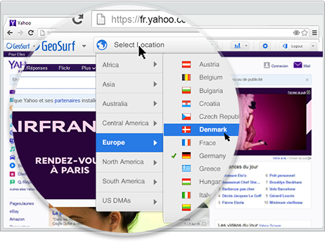 |